 |
ANTIQUE MAPS OF HUNTINGDONSHIRE AT
|
ANTIQUE MAPS OF HUNTINGDONSHIRE | |
| CLICK ON REFRESH/RELOAD TO ENSURE YOU HAVE THE UPDATED VERSION OF THIS PAGE | |
 |
BLAEU, Joan Willem, 1598-1673 : HVNTINGDO-NENSIS COMITATVS; – HUNTINGTON SHIRE. [Amsterdam : 1645 (or later)]. One of the finest antique maps of the county, handsomely decorated with a ribanded display of coats or arms, the Stuart royal arms, and a splendid hunters and hounds title-piece, with stags, falcon, boar, hare and rabbit. Originally produced by Blaeu in 1645 and here in a fine early impresssion. SOLD |
![ANTIQUE MAP: [MAP OF HUNTINGDONSHIRE] HUNTINGDON SHIRE; DIVIDED INTO ITS HUNDREDS : CONTAINING THE BUROUGH & MARKET TOWNS, RIVERS, ROADS, DISTANCES &C.](16362.jpg) |
BOWEN, Emanuel, fl.1714-1767 : HUNTINGDON SHIRE; DIVIDED INTO ITS HUNDREDS : CONTAINING THE BUROUGH & MARKET TOWNS, RIVERS, ROADS, DISTANCES &C. London : W. Owen, 1760. A most attractive mid eighteenth-century map, with a pretty rococo cartouche, by Emanuel Bowen, Geographer to George II. Originally produced for the February 1760 issue of "The General Magazine of Arts and Sciences". £50 To purchase, call us or e-mail us at maps@ashrare.com quoting stock number 16362 – or simply click on the button
|
 |
[MOULE, Thomas, 1784-1851] : HUNT INGDON SHIRE. [London : G. Virtue, 1832]. A fine antique map of the county prepared by the antiquary Thomas Moule. Decorated with five coats of arms, an ornate gothic border, a ribbon title intertwined with flowers, and inset views in roundels of Hinchingbrook and Brampton Park, etc. Originally engraved by William Schmollinger (1811?-1869) for Moule’s part-work series “The English Counties Delineated” (London : 1830-1837) – and here in very early state, before the addition of railways, etc. £75 To purchase, call us or e-mail us at maps@ashrare.com quoting stock number 43918 – or simply click on the button
|
 |
[MOULE, Thomas, 1784-1851] : HUNT INGDON SHIRE. [London : G. Virtue, 1832 (but later)]. A fine antique map of the county prepared by the antiquary Thomas Moule. Decorated with five coats of arms, an ornate gothic border, a ribbon title intertwined with flowers, and inset views in roundels of Hinchingbrook and Brampton Park, etc. Originally engraved by William Schmollinger (1811?-1869) for Moule’s part-work series “The English Counties Delineated” (London : 1830-1837) – the present version, showing some development of the railway system, is dated to about 1848. £50 To purchase, call us or e-mail us at maps@ashrare.com quoting stock number 12877 – or simply click on the button
|
 |
[SMITH, Charles, fl.1801-1853] : HUNTINGDONSH. London : C. Smith, [1828]. One of the scarcer nineteenth-century maps of the county, originally engraved by James Gardner (fl.1822-1846) for Charles Smith’s “New English Atlas” (London 1822). This slightly later edition was published in 1828. £40 To purchase, call us or e-mail us at maps@ashrare.com quoting stock number 16361 – or simply click on the button
|
 |
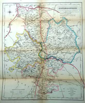
WALKER, J. & C. (WALKER, John, 1787-1873 & WALKER, Charles, 1799?-1872) : HUNTINGDONSHIRE. London : Longman, Rees, Orme, Brown & Co., [ca.1860]. A clearly engraved map of the county from the Admiralty engravers John & Charles Walker on a scale of something under three miles to the inch – particular attention being given to the newly built railways. Originally published in 1835, but here in a later and updated version. £25 To purchase, call us or e-mail us at maps@ashrare.com quoting stock number 30720 – or simply click on the button
|
| |
Return to Ash Rare Books home page. | |
